Monday, July 03, 2006
(click to see larger version)
This was actually my third time in a year in the part of the world, the Colorado Plateau. If you haven't been there, and you like either nature or photography, or the outdoor in general, you've gotta go there.
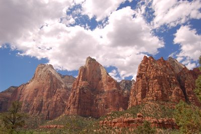
We flew into Las Vegas, Nevada, on an early morning flight. We got a rental car, stocked up on gallons of water and rations, and off we drove into Utah, land of the Mormons, to visit Zion National Park.
Zion is crowded. It is only three hours from Vegas, and half an hour from I-15, that's why. We took the shuttle to see various sights in the canyon floors, which didn't really do justice for what the park has to offer. Most of the really cool things in Zion require you to be there for the whole day, like hiking to the Angel's landing, or through the Zion Narrows, for example. Anyhow, this will have to be left for the future trip with more adventurous companions then (I'm traveling with my family this time).

After Zion, we sprinted to Bryce Canyon, got there in 2 hours. It was May, and hence just the start of the spring at such altitude, and there is life everywhere.
Bryce Canyon as shown below is a really spectacular place. Those delicate stone formations are called Hoo Doos. Part of reason for its origin is the very high altitude of Bryce, at close to 9,000 feet, on par with Doi Inthanon.
After an overnight stay, we hiked into the canyon in late morning. It is really an amazing experience. Down at the bottome of the canyon, the light there is deeply colorful. A particularly narrow section is called the 'Wall Street', presumably after the man-made concrete canyon in NYC. A Douglas fir at the end of the canyon provides a classic shot of inspriging photo. The hike is slightly less than 2 miles, so it was very doable for most people, as long as they pace themselves.
We finished Bryce Canyon around lunch time, so after an All-American fast food lunch, we sprinted off to Page, Arizona. Making good times, we decided to take the longer and more scenic route at the base of the Vermillion Cliffs, skirting the north rim of the Grand Canyon.
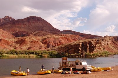
Making good time, we stopped by the Navajo Bridge, and drove to the river's edge at Lee's Ferry. Dip my hands in the Colorado river. The amazing geology of the Colorado river is such that, the river has cut a very deep canyon for hundred of miles, so there's really no way to cross the river, except at very few points like, at Lee's Ferry, where the Paria river joins the Colorado river. You can read about it here; it's quite fascinating.

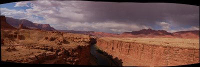
Panoramic view of the Marble Canyon, from Navajo Bridge, looking toward Lee's Ferry. The Colorado River is hundred of feet below.

If you ever want to raft through the Grand Canyon, you will have to get on board at Lee's Ferry. Rafting the Grand Canyon takes about two weeks of time, and about $4,000 or more of money (per person), so it's really well beyond my disposable income level.
We stayed over night in Page, Arizona. A new city that owes its existence to the Glen Canyon Dam. The Colorado river is dammed here, which created Lake Powell. Lake Powell flooded the very very scenic Glen Canyon. I think it is by far the most spectaculay man-made lake in the world. I have been fortunate to experience it up close last Labor Day, and maybe I'll get to write about it later.
There's a lot of controversy surrounding the Glen Canyon dam. Some people wanted to tear down the dam to restore the natural, seasonal flow to the river. As you can see from the size of the dam, this is not a trivial undertaking.
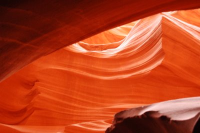
The Colorado Plateau are made of layers of sedimentary rocks, like limestone, sandstone, clay, and so on. It was dry enough that there's not much plant growth there. It was wet enough, mostly by sudden and very localized burst of water from summer thunderstorm, that there is very significant erosion. One of the unique features of this part of the world is the slot canyon. There, a narrow crack in the rock, got widened and smoothed by flash flood, creating a narrow passage a few feet in width but tens to hundreds of feet in depth. Down there, the light is very spectacular, as you can see from the picture below.
By far the easiest slot canyons to get to are the Antelope canyon, just a few miles off of Page. It was on Navajo Indian reservation land, so we are required to hire a Navajo guide. I took lots of pictures there... though without the tripod, it is quite tricky. With my new D50, I can get good results hand-held using ISO1600, but the depth-of-field is not quite there.
We spent a fortune to visit both the upper and lower Antelope canyons. By the time, we're done, a blowing sandstorm was in full force. We retreated into Page, for a KFC lunch, and drove to Kayenta, Arizona, another 100 miles, through drifting sands, dark skies, and rolling tumbleweeds.... very exciting.
We checked into the motel in Kayenta, and decided to wait out the storm. Originally we planned to go to the Monument Valley to see the sunset there, but by the time the storm has passed, the park has already closed. So, we kept on driving a little more, crossing the San Juan river to see the Goosenecks.
Here's what it means to be 'meandering'. The river travels along a path of 6 miles, but the actual displacement is only 1 mile.